

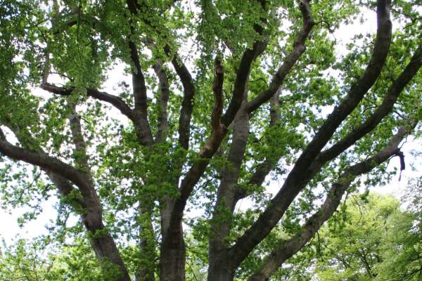
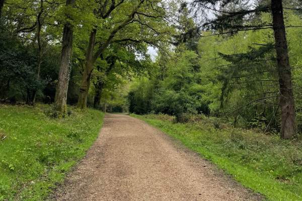
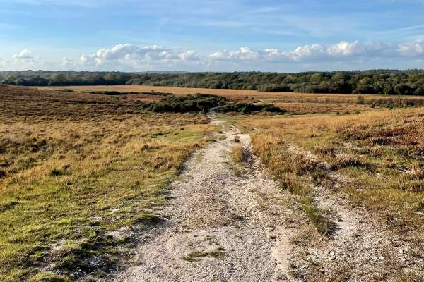
0.4 Mile On this walk you will end up at the wonderful Knightwood Oak, this tree is believed to be the largest Oak tree in the New Forest. Knightwood Oak is protected by a traditional cleft oak fence. Enjoy the surroundings on this very easy walk. Knightwood Oak Car Park…
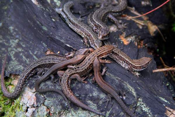
1.1 Miles Starting point from the New Forest Reptile Centre Car Park what3words ///oldest.brambles.bared The New Forest Reptile Centre is open all summer until the end of September Opening times of the Reptile Centre are seasonal. Please see the Forestry England website for…
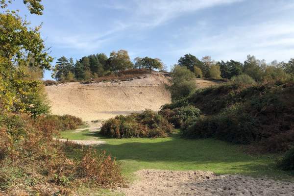
Distance: 0.7 miles (1.1 km) Start: Blackwater car park, Grid ref. SU 268 047 what3words ///crawler.secure.respected An easy waymarked circular walk through the Arboretum to experience the woodland and take in the variety of tree species. There are regular seats with…
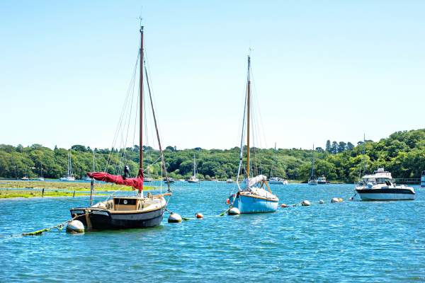
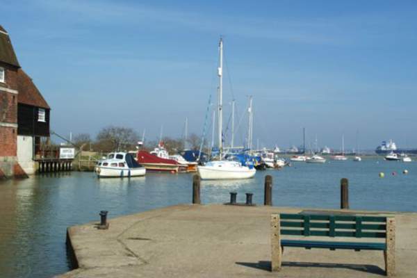
1.9 Miles Keyhaven is approached from Milford on Sea. It is a small village with a very pretty harbour. There are easy walks along the sea wall with views of Keyhaven harbour, the Isle of Wight and Hurst Spit. The area is a good spot for bird watching. Keyhaven Car Park…
Distance: 2.6 miles (4.2 km) Start: Godshill Cricket Pitch, Postcode SP6 2LL what3words ///steadier.tingled.thanks This walk takes you along quiet field and woodland paths to the site of an Iron Age hill fort. It then continues to a stream-side hamlet on the edge…
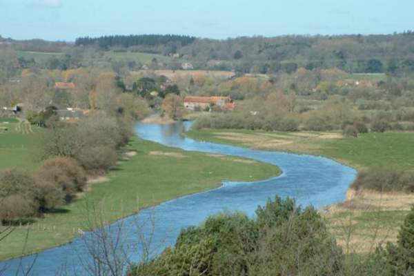
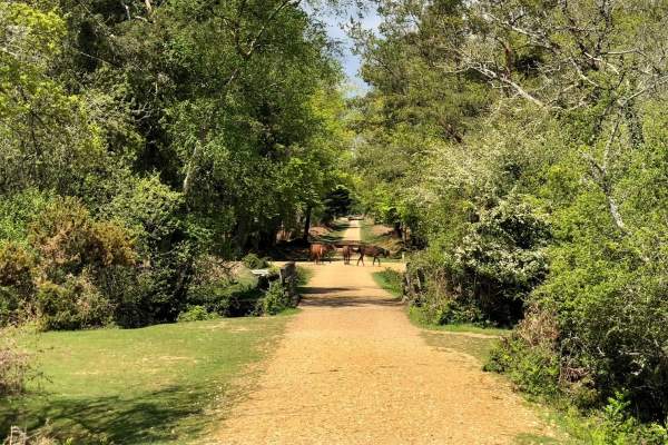
Distance: 2 Miles Start: Starting point : Beaulieu Village Centre what3words ///cheetahs.swerving.mammoth One of the most popular routes for families is from beautiful Beaulieu to the historic Buckler’s Hard as the route follows a two mile footpath along fields and…
Distance: 3.6 miles (6 km) Start: Chapel Lane, East Boldre, Brockenhurst SO42 7WP what3words ///voltages.during.games A level, 3.6 mile loop starting at Chapel Stores – a non-profit community shop selling drinks, snacks and ice cream. Alternatively join this…
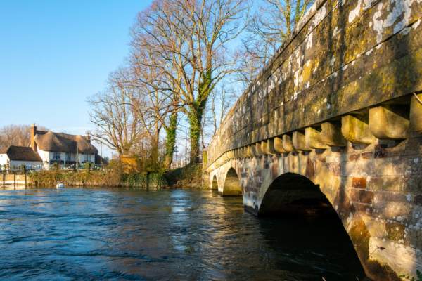
Distance: 2 miles (3.2 km) Start/End: Lymington Town Railway Station, SO41 9AU what3words ///lives.notion.calendars A shorter walk packed full of local history. Visit St Barbe Museum and Art Gallery, the modern day…
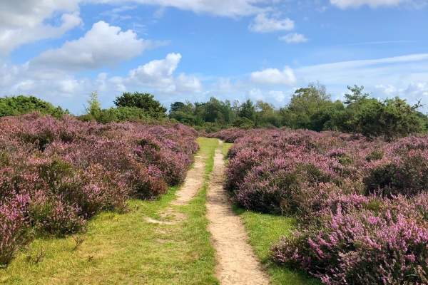
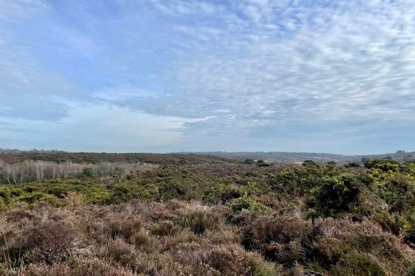
Distance: 2.5 miles (4 km) Start: Rockford Common Car Park, Grid reference – SU164083, BH24 3NF what3words ///spillage.spacing.legal Rockford Common is an area of open heathland and woodland, grazed by livestock belonging to local commoners. The area is…
Distance: 1.1 miles (1.8 km) Start: Blackwater car park, Grid ref. SU 268 047 what3words ///crawler.secure.respected This is an easy walk through woodland, passing through the Arboretum which houses a beautiful collection of trees from many countries. The walk…

300 Metres This is a New Forest Access For All route. This is an easy walk around the Pond, enjoying the views of the water. Janesmoor Pond is located just south of Fritham on the road to Stoney Cross. what3words ///bachelor.tilting.gong Click for PDF of route and more…
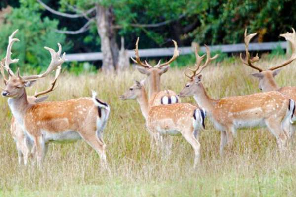
Distance: 0.3 miles (0.5 km) Start: Bolderwood car park, grid ref SU 243 086, no postcode. what3words ///shell.frog.reserving This very short stroll from Bolderwood car park leads you to a deer viewing platform overlooking fields where wild herds of fallow deer are…
Distance: 1 mile (1.6 km) Start: Bolderwood car park, grid ref SU 243 086, no postcode. what3words ///shell.frog.reserving Starting from Bolderwood car park this meandering route leads you past the deer fields and some majestic trees, the oldest of which date…
Distance: 4 miles (6.5 km) Start: Pollards Moor Road bus stop, Copythorne Grid ref. SU 303145, Post code SO40 2NZ what3words ///pink.confronts.songbook This walk starts by passing St Mary's Church before winding through Copythorne Common and its interesting mix of…
Distance: 1.9 mile (3.1 km) Start: Bolderwood car park, grid ref SU 243 086, no postcode. what3words ///shell.frog.reserving Once past the Radnor Stone, this trail passes through sweet chestnut, oak and beech dating from the 1860s. It then skirts the fenced boundary of…
500 Metres Cadman's Pool : what3words ///resurgent.bitter.flamenco This is a New Forest Access for All route. Great for picnics during your gentle walk, or just to sit and enjoy the view of the Pool. Take a short stroll around Cadmans Pool and enjoy the…
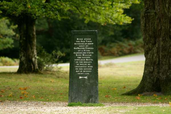
0.2 Miles Starting point : Rufus Stone Car Park what3words ///kite.visits.cuddled This is a New Forest Access For All route. The Rufus Stone is a very short walk from the car park on a good gravel path and the legend on the stone is worth the effort. The Rufus Stone marks the…
This Town Trail around Ringwood’s old town centre, designated a Conservation area, has been compiled by The Ringwood Society. We hope that this walk has encouraged you to take a closer look at Ringwood and to discover for yourself the attractions of our historic…
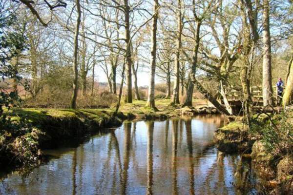
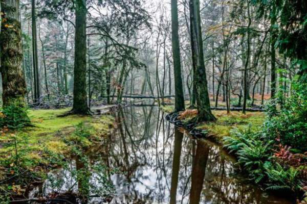
Distance: 1 mile (1.6 km) Start: Whitefield Moor car park, grid ref SU 274 026, no postcode. what3words ///ideas.dinner.ascendant Starting from Whitefield Moor car park, this walk passes along gravel tracks through a variety of habitats around Ober Water…
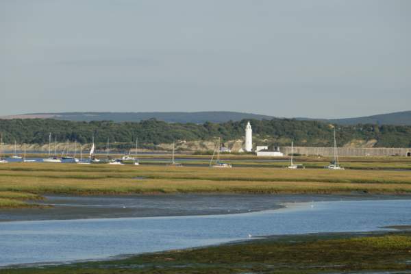
1.9 Miles Start : Hurst Road East Car Park what3words ///encroach.adhesive.bigger This is an Access for All Easy-Going Walk. Milford-on-Sea is on the New Forest boundary 4 miles south west of Lymington on the B3058. It has a shingle beach and great views of the Solent and the…
Distance: 2.8 miles (4.5 km) Start: Fawley town square bus stop Grid SZ 458 032 Postcode SO45 1EA. what3words ///mountains.poppy.perfected This walk is great for families with young children, starting from Fawley town centre and following a…
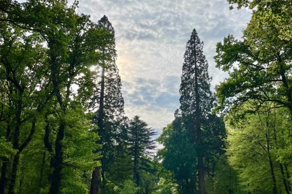
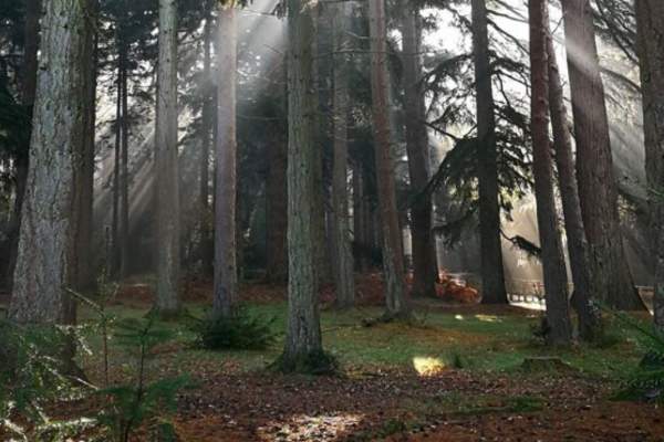
Distance: 1.4 miles (2.3 km) Start: Blackwater car park, Grid ref. SU 268 047. what3words ///crawler.secure.respected Stimulate your senses on this short but wonderful trail around the Tall Trees Walks. This walk takes you past majestic conifers planted in the…
2 Miles Milford on Sea is on the New Forest boundary 4 miles south west of Lymington on the B3058. An excellent walk starting on a sealed surface of fine gravel embedded in tarmac, with wonderful views of the Solent and the Isle of Wight. Then following the more rural…
Distance: 1.6 mile (2.6 km) Start: Whitefield Moor car park, grid ref SU 274 026, no postcode. what3words ///ideas.dinner.ascendant Starting from Whitefield Moor car park, this walk takes you further along the Ober Water than the yellow route, giving more time to…
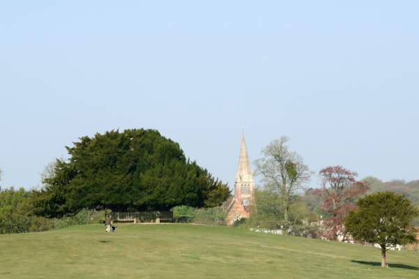
Distance: 2 miles (3.3 km) Start: Minstead Village Green, SO43 7FY what3words///directors.piglet.commenced Explore the quaint village of Minstead on this lovely, short walk. Start at the Village Green, visit Furzey Gardens and pass All Saints Church, which is were…
Distance: 2 miles (3.2 km) Start: Setthorns Car Park, Brighton Road, Sway, SO41 6EB what3words ///sideboard.tripods.entitle Enjoy a relaxed walk through this wonderful inclosure. Follow winding pathways through woodlands, and head through the local campsite!
Distance: 1.7 miles (2.8 km) Start: Hawkhill Car Park, Beaulieu, B3055 what3words///holds.width.aliens This is a wonderful short walk around a beautiful New Forest inclosure. Enjoy walking along winding paths through tall trees - make sure you keep an eye out…
Distance: 1.8 mile (3 km) Start: Horseshoe Bottom Car Park, Burley Road, Brockenhurst, SO42 7UP what3words///archduke.nursery.homelands This excellent walk features grassland, heathland and woodland and is great for a quick forest adventure! Being a shorter walk…
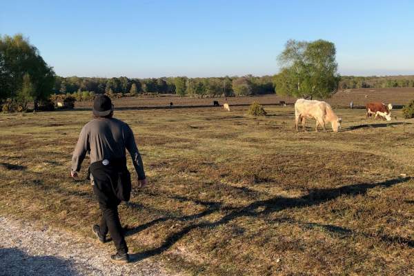
Distance: 2 miles (3.2 km) Start: Burbush Car Park, Burley, Ringwood, BH24 4EF what3words ///cinemas.craziest.pranced This is a walk is great for a short stroll or family walk, while taking in beautiful views and coming across wildlife, including our free-roaming…
Distance: 2 miles (3.2 km) Start: Beaulieu Road Station Inclosure Car Park, Beaulieu Road, SO42 7YQ what3words ///branched.joggers.refilled Park up, or enjoy this walk straight from the train getting off at Beaulieu Road Station, and head out on the pathway…
Distance: 1.8 miles (2.9 km) Start: Hythe Ferry, Prospect Place, Hythe, SO45 6AU what3words///drill.hugs.dinner Explore the brilliant town of Hythe! Stroll along the high street, enjoy view across the water, visit local parks and grasslands and walk…
8.5 Miles Discover the beauty of the parish, start from the thriving village centre, out to Bolton’s Bench and on into the tranquillity beyond. This walk roughly follows the whole outside parish boundary, using the forest as a natural tour guide. On this route you can…
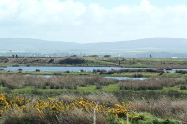
Distance: 3.5 miles (5.6 km) Start: Keyhaven green bus stop, SO41 0TG, Grid Ref: SZ 304 916. what3words ///glitter.courier.emotional Along the route there are views across the Solent to the Isle of Wight and the Needles and opportunities to watch the…
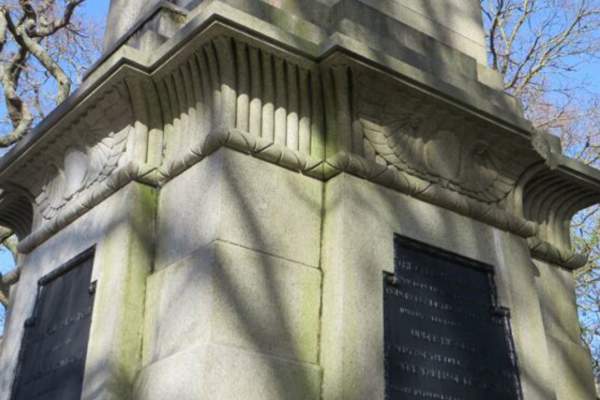
Distance: 3.2 miles (5.1 km) Start/End: Lymington Town Railway Station, SO41 9AU what3words ///lives.notion.calendars Visit the monument to Admiral Sir Harry Burrard-Neale (1765-1835), a prominent Naval officer and former MP for…
Distance: 3.1 miles (5km) Start: Bolton's Bench, Beaulieu Road, Lyndhurst SO43 7DA what3words ///shipwreck.gratitude.afford Bolton's Bench is known as 'the New Forest's gateway' and has lots of excellent path ways, with varied natural terrain. On…
Distance: 2.5 miles (4 km) Start: Hockey's Farm, South Gorley, Fordingbridge, SP6 2PW what3words ///thickens.elevates.glare Base your New Forest adventure around the wonderful Hockey's Farm! This walk starts and ends at Hockey's Farm, giving you the…
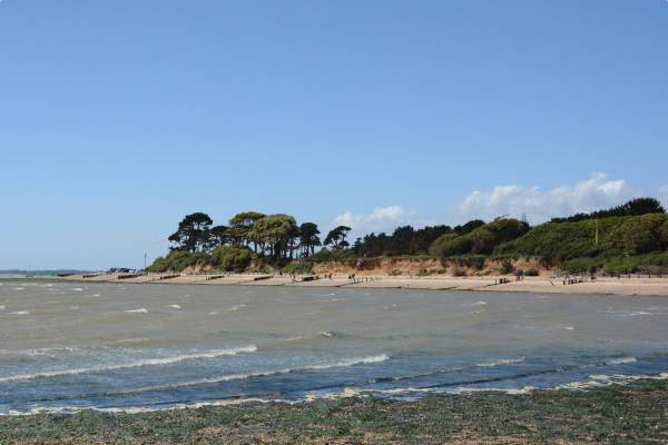
Distance: 5.9 miles (9.3 km) circular section Start: Lepe Country Park, SO45 1AD what3words //////graph.tasks.splat Start at Lepe Country Park and follow the oak signposts around the route. Situated on the southern edge of the New Forest and a mile from the Solent…
Distance: 3.1 miles (5km) Start: Anderwood car park, Lyndhurst Road, Burley, grid ref SU 24894 05782, no postcode what3words///dressings.acrobat.limitless This lovely New Forest walk will take you along gravel tracks, passing by heathlands and into woodlands. Plus…


